SWARKESTONE WALK
THE WALK
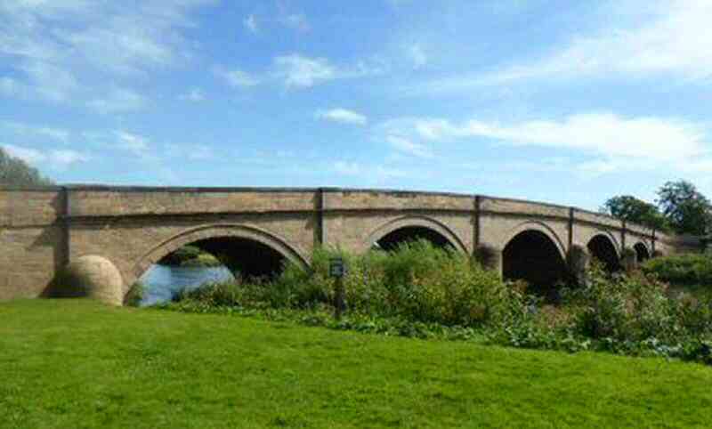
Swarkestone walk is an easy relaxing walk. For the most part, it follows the banks of the Trent and Mersey Canal. The walk includes a visit to Weston-on-Trent, which has been inhabited for centuries; on the southeast side, the remains of an Iron Age settlement have been found. Early settlers were attracted by the fertile soil.
LOOK OUT FOR
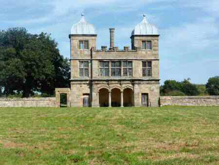
Point 4 – The most unusual building on the Swarkestone walk is the Summer House, sometimes called ‘The Grandstand,’ which has a grass-covered rectangular enclosure in front. No one is quite sure what its use was; bull-baiting and jousting are suggestions. More likely, the much gentler pursuit of bowling took place on the green. The building is now in the hands of Landmark Trust and is let for holiday accommodation. Little remains of the hall, which stood just south of here, but the Old Hall Farm, built out of part of its remains still exists.
Point 7 – Weston Cliff, a short distance to the west of the village is a favourite spot for anglers, artists and photographers, around which the canal curves on a narrow terrace. The old Cliff Inn, a former waterman’s Tavern, is now – Hospoda – the Ukrainian Country Social Club for the use of Ukrainians and their friends and other visitors. Sometime after the Second World War, one of the camps to the north of the church was established as the home of the Ukrainian Youth Association (CYM). It is still used by the Ukrainians to this day as a holiday centre. One of the camps is said to have been used as a venue for a concert featuring Vera Lynn and Glen Miller.
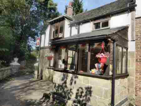
Point 8 – Locals refer to it as Weston-on-Trent, rather than Weston-upon-Trent as it is signed. It is seven miles southeast of Derby, a smallish village standing only a short distance from the river which gave it its name. It has, however, been the Trent and Mersey Canal that has most influenced its growth. The rapid expansion of industry in the second part of the 18th century required an improved and inexpensive transportation system if it was to be sustained. Much of the development was inland so the coastal route was usually out of the question. Rivers often obstructed by weirs, fish pools and inconsistent water levels rarely could be used for long-distance haulage. Roads had been improved by the growth of turnpikes but were not suitable for moving large volumes of goods. Packhorses were still relied on in Derbyshire to transport goods – slowly and laboriously. A solution to this problem was found by the establishment of a network of canals and when this happened Weston was well placed to benefit.
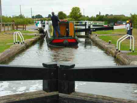
Point 10 – No visit to Weston is complete without a walk along the delightful stretch of canal from Weston Lock to The Cliff. Like both the lock and bridge, the canal milepost is listed for protection. Constructed in 1770, the lock is one of the deepest on the Trent and Mersey Canal. The bridge provided the crossing point for King’s Mill Lane, which at one time, was one of the main routes in the country for travellers moving from north to south and vice versa. There was a ferry at King’s Mill which went out of service in 1942. But a chain ferry post remains as a reminder of the existence of the ferry. The Priest House Hotel on the Leicestershire side of the river is set in a converted mill tower, where a mill has stood for over a thousand years.
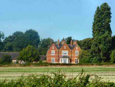
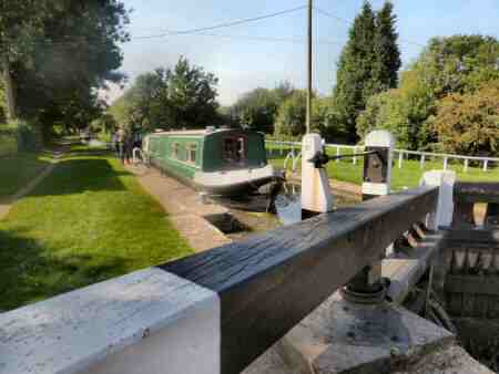
Point 11 – At Swarkestone Lock an arm of the Derby Canal used to branch off linking it with Derby. All that survives is about 50 yards of the canal and the former toll house converted into the headquarters of Swarkestone Boat Club. In ancient times the River Derwent had been used for transport from the River Trent, but it was winding and shallow in many places and silt was a constant problem. The Trent was a little better. James Brindley, the famous canal builder, had planned to link the Trent and Mersey Canal with Derby but was prevented from doing so by vested interests. As a result, nothing further happened until Benjamin Outram was eventually commissioned to build the canal, which was completed in 1796, providing Derby with a reliable water transport system. The canal ran from the Trent and Mersey Canal at Swarkestone to Derby and Little Eaton, and to the Erewash Canal at Sandiacre. James Brindley, who could neither read nor write properly, but had a brilliant brain, was responsible for the construction of the Trent and Mersey Canal. His most celebrated enterprise was the Trent and Mersey Canal, known as the Grand Trunk, which connected canal systems throughout the country.
Point 12 – It was at the Lowes, situated on a ridge overlooking the village, where archaeological excavations in 1955 and 1956 made some remarkable discoveries. The first was of a Bronze Age burial; a year later, archaeologists found even more striking evidence of structures by the Beaker People of about 2000 BC, along with a small amount of Neolithic pottery. In more recent times horse racing took place on nearby Sinfin Moor when the Crewe and Harpur Arms at Swarkestone had a stable block that completely encircled its present-day car park. This was used not only to stable carriage horses but racing horses as well.
SWARKESTONE WALK DETAILS
Length: 6.25 miles.
Start: Crewe and Harpur Arms (please park at the bottom end of the car park away from the pub and call for refreshment after completing the walk, otherwise park near Swarkestone Lock and follow the walk from Route Point 11). The pub is situated to the north of Swarkestone Bridge and Causeway, on the A514 close to its junction with the A5132 leading from Willington to Chellaston (SK369287).
Terrain: Easy, level walking with good views may be a little muddy in places.
THE ROUTE
- Walk to the right out of the car park entrance of the Crewe and Harpur Arms and continue a short distance down the pavement before crossing the A514, opposite the pub. Follow the footpath by the river for a few yards before going to the left along a path behind the houses facing the riverbank.
2. Cross the road into the village and walk to the left past Swarkestone Church. Immediately you have passed the church, go to the right by the churchyard wall to cross a stile into a field.
3. Turn sharp right to follow the field boundary at first and then where it bends to the right, keep straight on to cross the farm access track.
4. Continue straight on and walk alongside the wall on the southern side of the ‘Summer House’. At the end of the wall go through a gap into a field and continue straight ahead, to go over another stile on the opposite side of the field. Continue in the same direction across another field to cross a concrete access bridge into the next field.
5. Maintain the same direction for about 80 yards, before angling slightly to the left towards a solitary tree in the field boundary opposite. The tree is about 70 yards from the bottom right-hand corner of the field.
6. Go through the gap by the tree into the next field and head towards the top left-hand corner, as indicated by the waymarker post. Immediately you are through the gap in the top corner of the field, turn left to join the canal towpath – Massey’s Bridge (Bridge Number 12) is opposite.
7. Turn right along the canal towpath for just over one mile, until you arrive at a footbridge, which you cross and ascend a short steep path passing Hospoda – the Ukrainian Country Social Club, formerly The Cliff Inn.
8. Follow the access road to the right, before turning right along an enclosed path that takes you past Weston Lodge and St Mary’s Church. Immediately you are past the church, turn sharp right and walk through the cemetery, keeping close to the wall. Go through an obvious gap in the wall and angle to the left along a clearly identifiable path through a large field.
9. Cross an access track by a parking area on the western side of Weston-on-Trent. Go down the path opposite the parking area, with a row of cottages on your left. Continue forward past Rectory Farm down Park Lane and then at a road junction keep to the right along Trent Lane.
10. Follow the lane without deviation as it bends to the right to reach Weston Lock. Then turn right and walk along the Trent and Mersey Canal for three miles (the route covers the section of the canal walked earlier – Point 7).
11. On arriving at Swarkestone Lock, you will be able to see the point where the former Derby Canal joined the Trent and Mersey. After spending a little time looking around this important canal junction, continue along the towpath as far as the first canal bridge.
12. Here you ascend the footpath to the left of the bridge and turn right down Lowes Lane for a short diversion. Lowes House is on the left and the site where prehistoric remains have been found is just over 300 yards to the northwest. Return to the canal bridge and continue down the lane past Swarkestone Nurseries. Cross the A5132, with the utmost care and walk down Woodshop Lane, this bends to the left back to the starting point for the walk.
