LITTLEOVER WALK
LITTLEOVER WALK
For a good part of this extremely pleasant walk, look one way and it will seem as if you are in the countryside, look the other and you will realise that you are on the edge of the city.
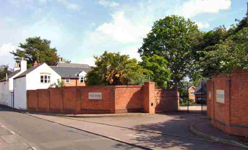
LOOK OUT FOR ON LITTLEOVER WALK
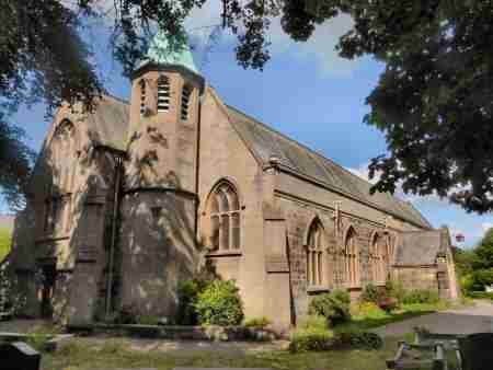
Route Point 1 – It was only in 1866 that Littleover became a separate parish from Mickleover, Findern and Potlock. The first church to be erected in the village was possibly a wooden structure and preceded the Norman Conquest, although there is no mention of it in the Domesday Book. A small stone church was built early in the 12th century, traces of which remain. The most prominent is the Norman doorway and font. On the other side of Church Street, St Peter’s Church School was built in 1846 and made provision for 110 boys and girls and 50 infants. Prior to the opening of the new school, education had been the responsibility of the church and a Dame School run in a private house.
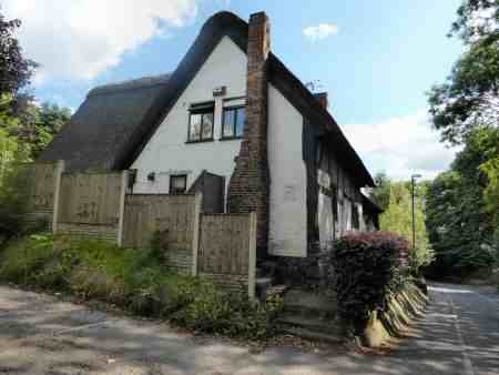
Point 2 – The Old Thatched Cottage in the Hollow at Littleover is the oldest surviving property in the village, and one of the few in Derby to retain its thatch. No one knows its precise age, but it probably started life as a labourers’ cottage in the 16th century. The Page family lived there for several centuries and Walter Haynes, the village hedge-cutter, is also listed as an occupant. It operated as an inn for a time before reverting to a private residence. The inn did a particularly good trade when race meetings took place at nearby Hell Meadow. Following the threat of demolition, it was restored between 1966 and 1975 and is now Grade II listed. On the opposite side of the road is an ancient stone trough, a reminder of the days when the horse played a vital role in both farming and travel. The trough was also used by cows when they were driven along the road both before and after milking.
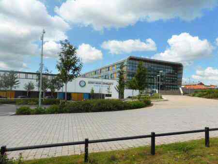
Point 5 – Derby Moor Community Sports College Trust, formerly known as Derby Moor Community School, is a secondary school. The Old Derby School moved from St Helen’s House in 1966 to the new purpose-built school complex on Moorway Lane. Following this move, St. Helen’s House was used first as the Joseph Wright School of Art and, then as an Adult Education centre until it was deemed unsafe. Following extensive renovation, it is now occupied by Smith Cooper Accountants. Ivy House Special School is also located on the same site on Moorway Lane but in a separate building.
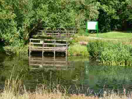
Point 8 – Sunnydale Park and Nature Reserve is the only Local Nature Reserve in the area. It was created from wasteland and old allotments and now provides a wide range of habitats for plants, insects, birds, fish, and animals. There is a network of paths, which lead visitors around the reserve, the majority of which are surfaced. The pond and the bridge over Cuttle Brook provide popular viewing points. A children’s play area and plenty of open space also make the park a place that the younger generation enjoys.
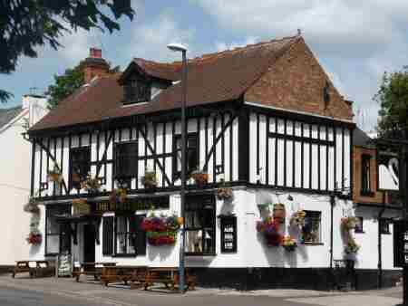
Point 10 – The row of cottages which line Church Street and back onto St Peter’s churchyard is said to have cost £17 each when they were built. This was where the original village used to stand, which consisted of several tiny houses, clustered around the church, built using mud and stone or timber framing with thatched roofs. Farming was the main occupation of the villagers. For centuries the area near the bottom of Shepherd Street, around where the White Swan now stands, a blaze of colour with its summer flower displays, was the centre for village gatherings. Here there was a square where fairs, feasts and markets were held and ceremonies would take place on public holidays.
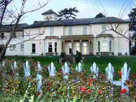
Point 11 – The Grange stands behind the supermarket on Burton Road and, lost its park to the developers. A large white house, it was built in the early 1800s and at one time was occupied by Rueben Eastwood a local iron founder. It was Eastwood who added the campanile so that he had somewhere to go after dinner to smoke. In the mornings the glow from his foundry, which he could see in the distance, ensured that his workers were hard at work. The Grange is now in the hands of the Freemasons and the stables have been converted into a community centre. Following a fire in April 1991, the hall has been substantially refurbished.
ROUTE
- You commence Littleover walk from the shopping area. Walk in a westerly direction along Burton Road, until you come to Shepherd Street where you turn left. A few yards after passing the entrance to Church Street, turn right along the path through the churchyard. Walk-in front of St Peter’s Church and follow the path as it angles slightly to the left to leave the church grounds.
2. Continue in the same direction to reach the roadway by the side of the Old Thatched Cottage, in The Hollow. Turn left down The Hollow and then right, a few yards below the junction with Hillsway. Cross the busy road and follow the path behind the bus shelter, keeping straight on when you reach Austen Avenue to enter Clemson’s Park along a surfaced path.
3. Maintain the same direction through the park, passing King George V Playing Fields, before the path eventually descends to reach Richmond Close and then Queensbury Chase. Go to the left along Squires Way and follow it round to reach Maize Close, where you turn right and after a few yards keep straight on along an estate path.
4. At the end of the path, turn left, with a roundabout in front of you. After a few yards cross a road and continue straight on to reach a path that runs along the southern side of old Heatherton. Turn left along the path that takes you to Moorway Lane, which you cross, before walking all the way around a very large and partially wooded area to reach the road.
5. Cross the road and turn right to follow the path that is separated from Moorway Lane by a hedge. Shortly before reaching Derby Moor Community Sports College, go through the first opening on the right. Cross the road, and follow a surfaced path*, signed ‘Moorway Lane Open Space and Millennium Wood’.
6. When you come to a fork in the path, keep to the right and follow it as it loops around to an exit point on your right. Here you turn to the right past an information board and walk down an access road to reach Oaklands Avenue.
7. Turn left up Oaklands Avenue and at the top go to the left up Blagreaves Lane. After a few yards go across the road to a surfaced path that takes you across an open space of grassland. Ignore the first path crossing you come to and continue straight ahead.
8. After a short distance, you take the next path on your right along a route that winds through the trees to reach Sunnydale Park. Follow the path around the edge of the park until you reach a ‘T’ junction of paths. Here you turn first right and then almost immediately left, to walk over the bridge and through the trees by the side of the pond.
9. On reaching a path junction, do not continue onto Willson Avenue, but turn right and follow the path as it curves to the left behind some houses to reach Rosamund’s Ride. Here you turn right along the road and then left 70 yards into Serina Avenue. At the top of the Avenue, follow the path to the left of ‘Number 35’ and continue close by the hedge all the way to Trafford Way, where you turn left and then right at the end of the road.
10. In approximately 100 yards, cross the road near the roundabout and continue straight on up Normanton Lane. Twenty-five yards past the White Swan public house, turn right up a driveway, where a footpath sign points to the left behind the houses, which you follow.
11. On reaching the end of the path, turn right along Park Lane. Continue to follow the pavement as the road curves to the right, by the Grange and starts to descend. Halfway down the hill, go to the left across Shaldon Drive, where you take the first turn on the left and walk up Broughton Avenue. At the top, turn right and follow the path as it curves to the left to reach Burton Road, where you go to the left to return to the starting point of the walk.
