NORMANTON
INFORMATION
Where is it? – Normanton is situated approximately 2 miles south of the city centre.
What to do? – Enjoy a stroll around attractive Normanton Park; walk down Normanton Road and take a look at the varied range of shops and restaurants that serve a diverse range of cultures; visit Foresters Leisure Park and enjoy a game of ten-pin bowls.
Where to eat? – There are a large number of restaurants to suit all tastes in Normanton.
Other places to visit – Derby Cathedral is a superb place to visit with its impressive Perpendicular Tower. The second-highest in England to the Boston Stump. The Cathedral Centre on the opposite side of the road holds some of the Cathedral’s treasures – Derby Arena provides a venue for sporting events as well as exhibitions, concerts, product launches and conferences. The Arena’s cafe, Café 42, is an excellent place to take refreshments and at peak periods watch cyclists riding the track in the background. – Take a stroll around Mercia Marina and browse the shops and explore the sensory garden and wildlife walks.

PROFILE
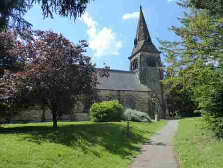
Normanton is an inner-city suburb of Derby situated approximately two miles south of the city. It grew from an ancient rural village, originally named Normanton-by-Derby. That is thought to have been the site of one of the major Viking settlements in the Derby area. In present-day terms, it is situated to the south of the Ring Road around Village Street, close to St Giles Church. However, the industrialisation of Derby saw the picture change and nearby farmland started to be used for housing. This gave birth to what has been called New Normanton. But nowadays the whole area is usually just referred to as Normanton.
Borough of Derby
By 1928 Normanton had become part of the Borough of Derby, which at the time needed to build new dwellings to re-house people living in condemned houses in Derby. The initial part of the Derby Arterial Road on the south side of the town was built with municipal housing estates on either side. Normanton Park, referred to by locals as ‘Normanton Rec’, was created at the bottom of Warwick Avenue, where it joined Stenson Road and led to the Cavendish, named after the Duke of Devonshire’s family.
Religion
Normanton Road is a bustling main thoroughfare, leading to Derby’s centre. It has numerous Asian shops, businesses and fast-food outlets and is well known for its range of Indian, Pakistani and Bangladeshi restaurants. To add to the diversity, the expansion of the European Union in 2004 has brought new immigrants to the area from various Eastern European countries. There are a wide number of places of worship to serve the various communities. The streets are frequently colourfully decorated for religious festivals. There were record crowds for the 300th Anniversary Procession of the Sikh Nation in 1999.
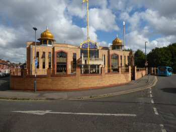
Guru Arjan Dev Gurdwara Sikh Temple
The Sikh Temple is located on Stanhope Street, Normanton and is a charity. It was registered on 8 February 1983 and is entirely self-funding. Many people donate time, food and money as part of their Sikh faith. The Gurdwara contains one of the largest free food halls in Derby and is open seven days a week for 14 hours a day.
New Life Church
The Church is at the junction of Normanton Road and Rose Hill Street. It was built in 1886/7 as a Congregational Church but closed in 1976. When the church merged with the Green Lane and Victoria Street Churches to form Central United Reformed Church. Shortly afterwards the premises were acquired by another group of worshippers who had been meeting as Whiston Street Assemblies of God Pentecostal Church. It later became known as the New Life Christian Centre. This was shortened in 2016 to New Life Church.
Normanton Barracks
Normanton Barracks, latterly the headquarters of the Sherwood Foresters regiment was once a prominent local landmark. For some time after the Barracks had been vacated the site was used by a variety of small businesses. Before its demolition in 1981 when it was replaced by Foresters Leisure Park. At the northwest end of the original barracks, the Oast House Public house was built. There was some initial apprehension in Normanton about the military setting up their Head Quarters in the village. That soon disappeared and turned into a feeling of great respect for the officers and men who lived at the barracks. Church parade on Sunday mornings was a very colourful affair, as the soldiers marched to St Giles Church, led by the band and regimental mascot, the ram – known as Private Derby. The men always sat in the south aisle, which became known as the ‘soldier aisle’. For many years the regimental colours were displayed in the church, but they are now on display in the regimental museum at Nottingham Castle.

Normanton Recreation Ground
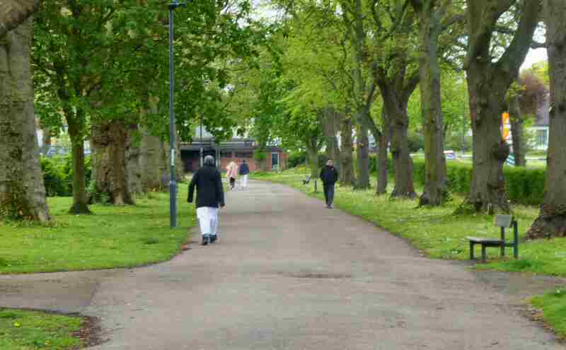
Normanton Rec as it is still frequently called is now known officially as Normanton Park. It was developed on the site of old brickyards and opened in 1909, to provide a place where local people could relax and enjoy fresh air, in a heavily populated area. The park links ‘Old Normanton’ with the newer and rapidly expanding industrial, inner-urban Normanton. Part of its southern boundary was lost to Warwick Avenue when the Ring Road was built, but tree planting helped to soften the gap that had been created. During the Second World War, trenches were dug in the park as temporary air raid shelters. The trees are now well-established and there are wide pathways around the park. On the Warwick Avenue side of the park, a car park has been provided and there are also foot entrances from Chatsworth Street and Fairfield Road. Following repeated vandalism, the park has been substantially refurbished. The Derbyshire Tennis Centre is adjacent to Normanton Park.
Cavendish Cross Roads
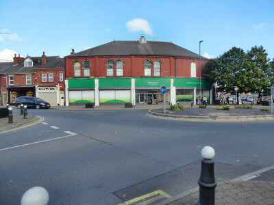
The Cavendish Hotel, when it was built in 1898, gave its name to the area, where five roads met; Stenson Road, Almond Street, Upper Dale Road, Walbrook Road and Derby Lane. In 1910, the sizeable Derby Co-operative Provident Society was built, which helped to establish a thriving shopping area. The other shops in the area helped to provide a wide range of facilities. Birds Bakery stood at the junction of Upper Dale Road and Almond Street, by the box where the tram conductors clocked in and out on the route to and from Derby. For several years the Bird family used to park their cars outside the bakery, which included an E-Type Jaguar and a Jensen Interceptor. Today, although much changed The Cavendish remains an important shopping area.
Derbyshire Tennis Centre
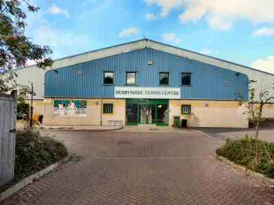
The Derbyshire Tennis Centre is located at Ashe Place, Normanton. It is owned by the Derbyshire Tennis Association and is a not-for-profit venue. Community venue open to all. There are two indoor and three outdoor floodlit courts available for players of all ages and standards. Coaching for all standards is available. Facilities include changing rooms, a lounge area/kitchen area, vending machines, a balcony to view indoor courts and a private car park.
