
Upper Hulme to Wolfscote Dale
UPPER HULME (off the A53, Leek to Buxton Road – SK011609)
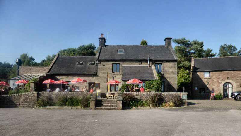
Although Upper Hulme is only a tiny village clustered around what was once one of Tatton’s Mills. Once well known for the production of black dyes. Despite being on a minor road, it gets exceptionally busy at weekends and busy holiday periods. It is the route used by walkers, cyclists and motorists, to access the Roaches and Hen Cloud and some of the most scenic countryside in the Peak District.
The houses in the village are built from local sandstone and are a lovely rose colour. There are two pubs, Ye Olde Rock Inn and the Winking Man on the A53 and the delightful Roaches Tearooms at Paddock Farm.
Ramshaw Rocks which rise impressively above the A53 have a rather unusual feature. As you approach the rocks from the Leek direction you will see, on your left the rough outline of a man’s head worn in the rock, with a gap in the eye socket, which as you pass appears to wink at you caused by rocks behind obscuring the sky for a moment. Not surprisingly the rock formation is known as the Winking Man and a little further along the road towards Buxton is a pub of the same name
WARSLOW (between the A523 Ashbourne to Leek road and the A515 Ashbourne to Buxton road – SK087587)
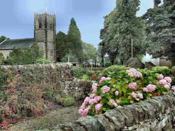
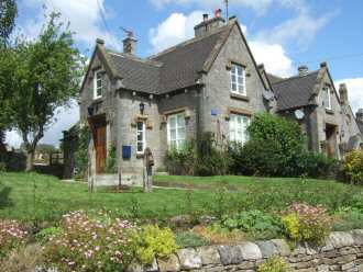
Standing at almost 1,000 feet above sea level, Warslow is a surprisingly large village for what is a fairly remote part of Staffordshire. Formerly an estate village of the Harpur-Crewe family of Calke Abbey in South Derbyshire, it is composed mainly of pleasant stone-built properties with a church provided by Sir George Crewe. The village lies on the western side of attractive wild moorland country, but it is far less forbidding to the east.
Visitors are most attracted to the gloriously rugged Manifold Valley, a spectacular limestone gorge, which stretches in a southerly direction from Hulme End to Waterhouses.
Warslow is recorded in the Domesday Book, under an entry for Alstonefield Manor, which may indicate it had been a separate estate before the Norman Conquest. But there are signs of habitation in the area which go back much further, a Bronze Age barrow having been discovered on the northeastern side of Warslow.
WATERFALL (8 miles northwest of Ashbourne off the A523 along minor roads from Waterhouses or Winkhill – SK081514)
The picturesque little village of Waterfall is well worth visiting. But you will not find a waterfall. The name has been derived from the fact that ‘this water sinketh underground.’ This is not an uncommon situation in a limestone area. The River Hamps falls into a subterranean watercourse between the villages of Waterfall and Winkhill, from which the former derives its name.
The village is particularly attractive surrounded by stone cottages and farms with impressive scenery as a backcloth. On the green is the old village pump, now disconnected and the restored village stocks. The oldest building in Waterfall is the parish church, believed to date back to 1100. The churchyard is unique in Staffordshire as it has belonged to the lay rector since the reign of James I. The local school closed in its bicentennial year and is now used as the village hall. The Red Lion has been described as a ‘hidden gem’, and is still going strong. It is very popular with walkers and is situated where several footpaths converge.
WATERHOUSES (on the A523, halfway between Leek and Ashbourne – SK080506)
Waterhouses is the largest village in the Hamps Valley on the southwestern edge of the Peak District. Situated at the southern end of the Manifold Way a converted railway line it is popular with walkers and cyclists. The Peak District Boundary Walk runs through the village and Brown End Quarry, a nature reserve of Staffordshire Wildlife Trust, is nearby. Ye Olde Crown Hotel in the centre of the Village is an important stopping point on the A523 as is the Riverside Café. Nearby is the Cauldon cement plant of Lafarge Cement, and a large Tarmac limestone quarry. The Church of St Mary is a Grade II listed building.
Waterhouses once had a railway station on the line to Leek. This was opened by the North Staffordshire Railway on 1 July 1905. Also, Waterhouses was served by the same railway company, which opened the Leek and Manifold Light Railway on 27 June 1904. It was a narrow gauge railway which ran from Hulme End in the north to Waterhouses in the south. The main intention was to provide a faster service for milk and dairy products from farms around the valley linking up with a daily milk train that ran from Waterhouses to London. It also provided easier transport for the copper mined at Ecton. Unfortunately, the line was not profitable and was eventually opened up for tourists, but still failed to make a profit. As a result, it was forced to close and has been replaced by a surfaced trail for walkers and cyclists only two miles of which is not car-free. There is a cycle hire centre and car park at Waterhouses
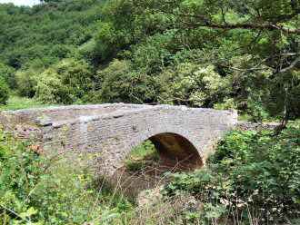
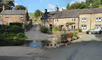
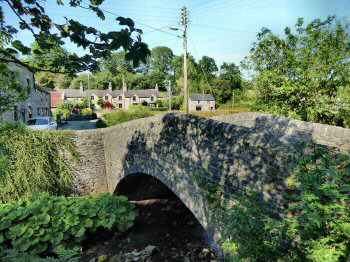
WEAG’S BRIDGE (west of Wetton on an unclassified road to Grindon through the Manifold Valley – SK100541)
The bridge where the road from Wetton to Grindon crosses the Manifold River is known as Weag’s Bridge. The valley sides are steep at this point, and the narrow road between the two villages has hairpin bends on both sides. In 1947 both villages were cut off from the outside world. At Grindon is a memorial to six men, who died when their aircraft crashed while ‘bringing relief to the stricken villages during the great blizzard of 1947’. Two press photographers died with the RAF men, shortly after parachuting food supplies to the people of Wetton, Onecote, Butterton and Grindon.
WETTON (off the Ilam to Alstonefield road – SK108555)
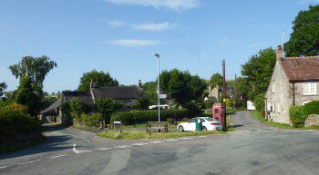
Wetton is a compact little village of limestone cottages, the gardens a riot of colour in the summer. It is in an exposed position against the cold at an altitude of about 1,000 feet and the little cottages seem to huddle together for protection. Winters are now much milder, but some older residents still recall when the village has been cut off from the outside world.
In the summer, Wetton is a picture with its pretty cottages and lovely gardens. It is not surprising that so many people decide to take their holidays in the village. For the more adventurous there is the campsite behind the pub. But for those who prefer four walls, there are plenty of choices.
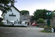
When the first World Toe Wrestling Championship was held in the village, a great deal of interest was generated locally and nationally. During the years it operated at Wetton, a lot of money was raised for charity and the pumps at the Royal Oak were kept busy. The competition consists of three rounds played with the right foot, then left and right again, with both men and women taking part. Eventually, the event was moved to the Bentley Brook Inn, Fenny Bentley near Ashbourne, where it remained for several years before returning to its former home. Later it was scheduled to take place at Ashbourne’s Ex-Servicemen’s Club.
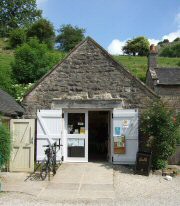
WETTON MILL (1 mile northwest of Wetton, in the Manifold Valley)
The mill is owned by the National Trust and the starting point of many walks. It is a popular spot with visitors to the valley and the tearoom, housed in one of the former grist buildings, provides welcome refreshment. There is ample parking space along the roadside.
It was originally a water mill used to grind corn. The remains of the millstream and an old grindstone can still be seen. The river beds of the Manifold and Hamps are frequently dry during the summer months. The water has gone underground into the porous limestone rocks. During dry weather, the Manifold disappears at Wetton Mill and re-emerges from its underground journey from a boil hole at Ilam. Ossum’s Cave at Wetton Mill is known to have been used in the Stone Age, where flints were fashioned. Wetton Mill had a railway station and waiting room, the mill ceased production before the railway line was built.
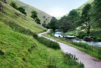
WOLFSCOTE DALE (approximately two miles south of Hartington SK134580)
From the northern end, Wolfscote Dale becomes progressively more spectacular, as you walk, with the sides of the dale rising almost vertically. At first, the sides of the valley alongside the River Dove are bare and rock-fringed, but this soon changes, with the slopes on the right becoming thickly wooded. The dale, rich in wildlife, is wilder than Dovedale and more unspoiled. A series of small weirs add to the beauty of the valley. After about one and a half miles of attractive scenery, you reach the cliffs of Drabber Tor, beyond which lies the entrance to Biggin Dale. The walk continues down the dale past Coldeaton Bridge to Lode Mill.
PART 1