
Calton to Ford
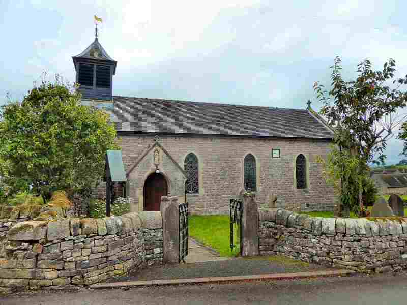
CALTON (off the A523 Ashbourne to Leek Road, east of Waterhouses -SK103502)
Calton is a tiny village in an attractive rural setting that has been part of Waterhouses Parish since 1934. The Grade I listed parish church, contains fabric dating back to the 12th century. In the churchyard are three Anglo-Saxon crosses, known as The Three Bishops. A short distance to the north stands the ruins of Throwley Old Hall. It is Staffordshire’s only surviving large medieval manor house and is now privately owned.
DANEBRIDGE (to the southwest of Buxton off the A54)
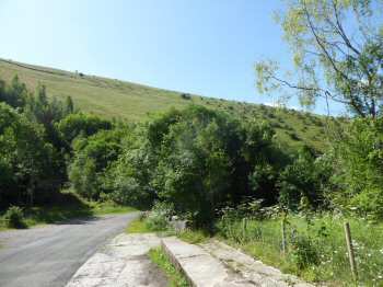
The Dane Valley is a beautiful unspoilt valley near the Staffordshire and Cheshire border. The striking woodland and moorland scenery make it a favourite destination for walkers who use the old packhorse routes to explore the valley. Many of the walks start from the bridge aptly named Danebridge. The River Dane flows under its broad arch, with its tributary the Clough Brook.
The small hamlet of Danebridge lies on the southern side of the bridge. Only a short distance up the road on the north side of the bridge is the Ship Inn often thought unusually named considering its distance from the sea. Even more mystifying is that the pub’s hanging sign depicts HMS Nimrod. This all came about as a result of Sir Phillip Brocklehurst accompanying Sir Ernest Shackleton to the Antarctic aboard the Nimrod. He lived at nearby Swythamley Hall in Staffordshire.
DOVEDALE (off the A515 north of Ashbourne, between Thorpe and Ilam)
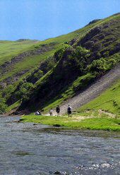
The River Dove rises on high ground at Axe Edge, near Buxton. Its clear waters meander southwards for 45 miles to eventually join the River Trent. For much of its course, the river runs through stunningly attractive countryside, with one bank in Derbyshire and Staffordshire on the other. It is a walker’s paradise, providing easy walks and strenuous hikes for the more experienced practitioner.
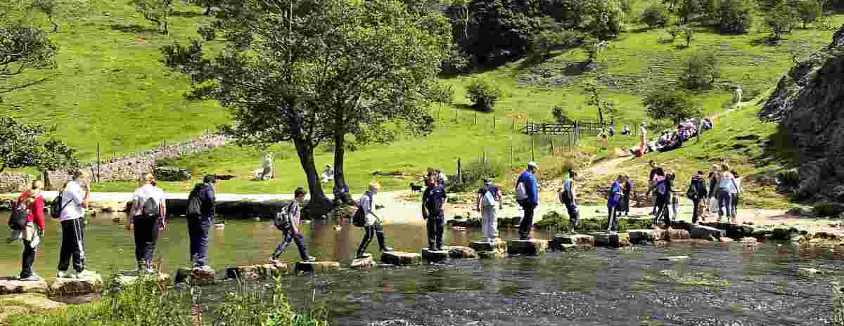
Dovedale, with its steep-sided limestone sides and tree-covered slopes, is the stretch of the valley that runs from the tiny hamlet of Milldale, down to the large car park close to the road linking Ilam and Thorpe. In some places, the water has eroded the limestone into spectacular rock formations, like the Lion’s Head and the natural archway in front of Reynard’s Cave. For the more energetic who climb Thorpe Cloud or Bunster, there are fine views across the valley.
The building of the Midland Railway in 1863 made the Peak only three hours from London. Many were the thousands who got off the train at Alsop-en-le-Dale Station and walked the length of Dovedale before catching a train home at Thorpe Station. The railway is no more, but cars and other forms of transport still bring thousands of visitors to what is one of England’s most famous beauty spots.
ECTON (on the eastern side of the Manifold Valley to the south of Hulme End that sits between Warslow and Hartington – SK096584)
Ecton is a hamlet on the Manifold Way, an 8-mile walk and cycle path that follows the former Leek and Manifold Valley Light Railway line. It is overlooked by Ecton Hill that according to archaeological research has been a source for copper mining since the Bronze Age. The mine was most active during the 18th century. When under the ownership of the Dukes of Devonshire, considerable investment was put into the mine to exploit the extensive rich copper reserves. At that time it was one of the richest copper mines in the world and helped finance the building of The Crescent at Buxton.
In the late 1700s, the mine employed around 400 workers producing 4,000 tons of copper a year. It was almost worked out by the turn of the next century and the Duke relinquished his interest. The mine finally closed in 1891. The Engine House still stands and is thought to be the oldest mine-winding engine house in the world. Now in the hands of the National Trust and during the summer months tours can be arranged which include going into the mine and onto the hill to look inside the engine house. Booking is essential.
FAWFIELDHEAD (to the east of the B5053 approximately one mile southwest of Longnor – SK074637)
The area in which one writer described the civil parish of Fawfieldhead lies as ‘the land of sheep and heather’. It contains 17 listed buildings recorded in the National Heritage List for England. Four Bronze Age barrows have been identified on the eastern side of the parish.
The hamlet of Fawfieldhead is mainly composed of a scattering of farms and cottages and is closely linked to the neighbouring hamlet of Newtown to the southwest.
FLASH (off the A53 Leek to Buxton road – SK025672)
Flash, surrounded by magnificent moorland scenery stands at a height of 1,525 feet above sea level and is claimed to be the highest village in England. It is an isolated place, consisting of well-weathered cottages and a small church, all clustered together seemingly to keep warm on the side of Oliver Hill. The village hall stands apart from the main village and acts as a memorial to the men killed in the Second World War. It was built by local people assisted by Quakers and students from all over the world and was opened in 1958.
The A53 runs only a short distance to the east of Flash and is frequently closed by heavy snow in winter. The harsh winter of 1947, still lives in the minds of many of the village’s older inhabitants, when the Peak was in the grip of violent blizzards. Telephone lines were brought down and hundreds of vehicles were abandoned as the roads around Flash came to a complete standstill. The situation was desperate as people became short of food and fuel and for a time the village lost contact with the outside world.
Only a short distance from the village is Three Shires Head, where a bridge crosses the River Dane at a point where the borders of Derbyshire, Staffordshire and Cheshire meet. Many years ago illegal prizefights used to take place there. At that time the police were not allowed to cross county borders, and it was easy for the wrongdoers to flee into another county. For the very same reason, counterfeiters choose the spot for their unlawful trade-in ‘flash’ money. The word flash has since become associated with being dishonest or for goods that are not of genuine quality.
FLASH BAR (on the A53 Leek to Buxton road – SK032678)
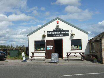
Situated just outside the village of Flash, is Flash Bar with its stylish café and stores. The shop and café are probably the highest above sea level in England. On the other side of the road is the Traveller’s Rest public house which has now reopened as the Knight’s Table.
Flash once had a benefit society to support those most in need, the Flash Loyal Union Society, which was established in 1846. It was nicknamed the ‘Teapot Club’ presumably because many members saved the club money in a teapot. Attendance once a year at an annual feast was compulsory for members when the money was placed in the benefit fund. Feast Day was an important day in the village’s social calendar and when in 1995 the benefit club had to be disbanded due to new Government regulations, the event was retained.
As one recent visitor who just happened to visit Flash on the day of the village parade recounts, she was astonished to see a procession march to the Traveller’s Rest carrying a large model teapot. Even more, the marchers also carried banners referring to the teapot and were accompanied by a brass band. On the same day, there is a service in the church and also well-dressing and a flower festival. Refreshments are provided in the village hall.
FORD (off the A523, Leek to Ashbourne road, west of Waterhouses – SK064540)
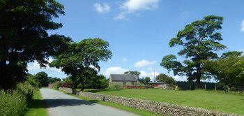
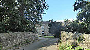
Ford is a quiet secluded hamlet where dairy and sheep farming predominates. It was once the place where Quakers who were being persecuted retreated to live in peace.
The old Ford from which its name is derived has been replaced by a humped-back bridge over the River Hamps.
PART 3 TBA