THE WALK
This is a most enjoyable walk with expansive views over open countryside, and a visit to the attractive village of Ockbrook, visiting the Moravian Settlement and passing All Saints’ Church. After leaving the village, the walk continues through fields and woodland, before climbing gently up to Hopwell Nook. From this point you follow a tarmac drive, passing over Ock Brook as you return to the village. A series of walkways between houses are soon followed to reach Green Lane, before returning to Spondon, past the rear of Ockbrook School playing fields, along a pleasant field path.
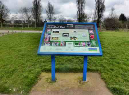
Route Point 1 – Located on the edge of Spondon on the A6096 road to Ilkeston, Dale Road Park is an open space, created in 1994, which provides easy access to a network of footpaths. It has seen considerable improvements, in recent years, to make it more visitor friendly. Further information about the park can be obtained from the information panel, situated close to the car park. Here details of the developments that have taken place in the park, its history and its facilities, are available in both written and audio format.
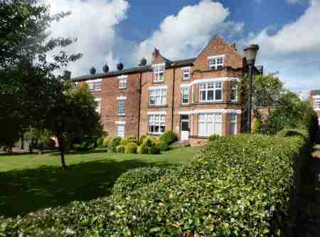
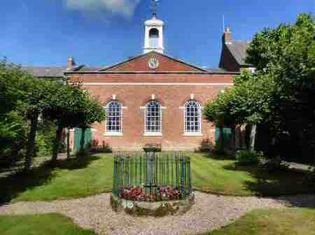
Point 3 – Ockbrook is situated just to the north of the busy A52 dual carriageway, and only a short distance from the outskirts of Derby. It has managed to retain much of its charm and at least a reasonable level of peace and quiet. There are two distinct parts to the village. The Old Settlement is where Occa, an Anglo-Saxon, and his people built their homes in the 6th century on the banks of the brook and from where the village derived its name. Alongside it is the Moravian Settlement, a product of the 18th century, with its delightful terrace of red-brick Georgian buildings and the strikingly attractive church which is approached up a tree-lined path.
Point 4 – The Moravian Church was founded in 1457, in Bohemia, and was based on simplicity in life and worship. In 1750, a Congregation of the Moravian Church was established in Ockbrook and after overcoming many obstacles, mainly due to local opposition, two years later a church was opened. During the latter part of the 18th century, the village was the centre of the Moravian Church in England. The Moravians were hard-working, highly disciplined people with strict rules. They attended to the basic medical needs of the community, built schools and opened a shop as well as administered to the spiritual requirements of the community
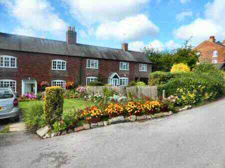
Point 5 – Shopstones Cottages were built as family houses by the Moravians. Visitors to the Settlement usually stayed at the New Inn, to the right of the cottages (now Greenside), which began business in 1792. The extension on the western side was used as a Sunday School and during the First World War as a hospital for servicemen. The Old Post Office, by the pathway below Shopstones Cottages, now a private house, was once the Moravian Congregation Shop, where ‘best quality goods at reasonable prices’ were offered by the brethren. On the other side of the wide grassed area in front of Shopstones Cottages are the first houses to be built for the Moravians. They are referred to as the ‘Houses on the Hill’. Here Jacob Planta an apothecary lived, who in 1781, is credited with successfully inoculating four women against smallpox. Fifteen years before Edward Jenner, who the history books record as the first person to discover the vaccination. The Manse and the Moravian Church are both Grade II listed buildings.
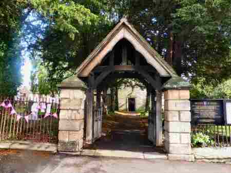
Point 6 – All Saints’ Church became the parish church around 1600, having previously served as a chapelry of Elvaston. The tower was built in the 12th century, and the spire was added later. The Norman font was restored in 1963 and returned to its rightful place, after being thrown out by a previous generation for use in the rectory garden. At the rear of the church stands Church Farm, a delightful timber-framed farmhouse dating back to the 17th century, which has been very substantially restored.
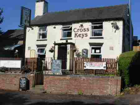
Point 11 – Cross Keys pub, owned by Punch Taverns, was so much in decline a few years ago that the leaseholder offered the lease for ‘sale’ for nothing. And there were no takers. Eventually along came Ian Darlington and a few years later it not only offers drinks but also serves food and is open all day. To add to the success story the pub made its debut in the Good Beer Guide, for 2016. Textile manufacture was very important in Spondon and framework knitting was carried on in cottages in the village. The Cross Keys fulfilled the joint function of a public house and silk stocking manufacturer; Queen Victoria’s wedding stockings were made on the premises! However, during the second half of the 19th century, competition from mechanisation slowly ended the cottage industry and the knitters’ window designed to provide the maximum light, which survived for many years has been recently replaced.
WALK DETAILS
Length: 3.75 miles.
Start: Take the Spondon turn off the A52 Derby to Nottingham road. Turn right along the A6096 for the centre of Spondon. Follow the A6096 towards Ilkeston from the centre of Spondon, until you arrive at Dale Road Park, which is about two-thirds of a mile north of the main shopping area. The Park is located on the right side of the road, near the edge of the village (SK413365).
Terrain: An easy, flat walk for the most part on well-defined paths.
THE ROUTE
- With your back to the entrance of Dale Road Park, turn right along a rough track to the park boundary, where you immediately turn right down a wide track.
- Continue straight ahead along the track, down the side of the park and maintain the same direction where the park ends. A short distance further on you will arrive at a ’T’ junction of paths, where you turn to the left along a wide footway. As you walk along you will be able to enjoy extensive views over the Derwent and Erewash valleys.
- Ignore all paths leading off to the right and left and soon the houses on the outskirts of Ockbrook come into view. As you get closer to the village; your path joins a field access route and bends sharply to the right. Opposite the drive to Ockbrook School (now closed), turn to the left up, The Settlement, where the Moravians established a church and community.
- Walk up a gentle slope past more school buildings into the heart of the Moravian Settlement. As the path starts to level out you will see a footpath sign on your right, but before taking the path walk a few yards further to view the Moravian Church, before returning to the footpath sign.
- From this point head diagonally to the right down a small field to reach Shopstones Cottages, go to the left along an access road and then a footpath to the left of the Old Post Office. Maintain the same direction as the path crosses two estate roads.
- Turn right in front of Ockbrook and Borrowash Parish Council Head Quarters, along Church Street. Follow the road past All Saints’ Church and continue forward down Cole Lane. As the lane starts to narrow and rise gently look out for a footpath sign on your left, by number 31 Cole Lane. Here you turn up a rough track. The track soon leads to a tree-lined path at the end of which you continue for a short distance close to the hedge on your left. When the hedge bends sharply to the left, turn right and take the second of two tracks heading diagonally across the field toward a line of trees.
- Go through a stile in the top corner of the field and turn right to walk alongside the hedge for two fields past Windmill Farm, where the ruins of a former tower windmill still remain. Go diagonally to the left-hand corner of the next field and cross a footbridge and continue to maintain the same direction in a large open field.
- Just before reaching an electricity cable running from the north to south across the field, turn left along a clear path aiming for approximately the mid-way point between a cottage on your left and a small plantation. On reaching a track linking Hopwell Hall and Ockbrook, turn left, soon passing Hopwell Nook and then continuing along a tarmac drive to Ockbrook.
- Turn left along The Ridings and after a short distance, turn right beside number 59. Turn right at a ‘T’ junction of paths to reach Yew Tree Avenue and turn left up the avenue. Where it bends to the right, continue straight ahead up a pathway between houses to arrive at Top Manor Close.
- Walk up the close to go along another pathway between houses coming out onto Pares Way. Turn right and cross the road after 20 yards to go up a pathway between numbers 50 and 52, which brings you out on Green Lane, where you go to the left.
- Cross the road and go down the side of the Cross Keys public house, take the second turn on the right, along Sisters’ Lane. At a footpath sign cross a small field to the left-hand corner, where you turn left to walk past a school playing field and along an access road.
- Ensure you only remain on the access track for a few yards – where the track bends to the right for a few feet – your route is through a wide gap in the hedge into a field. Continue forward along a well-trodden path, with the hedge close by on the right – all the way back to Dale Road Park and the start of the walk.
