REPTON WALK
THE WALK
Save this walk for a clear, bright day to enjoy the lovely views over the South Derbyshire countryside to the full. A glimpse of Foremarke Hall and its picturesque lake provides a bonus.

LOOK OUT FOR
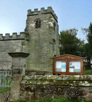
Point 5 – Sir Francis Burdett, built St Saviours Church on the estate at Foremark, in 1662, and many residents regard it as their local parish church. It is one of the first churches to be built in England after the Restoration of the Monarchy and the lifting of the ban on church building. The church was built to serve Formark and Ingleby and it is certainly worth a short diversion to take a closer look.
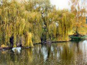
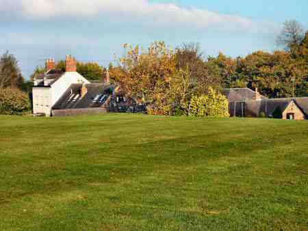
Point 6 – Foremarke Hall is an impressive Georgian mansion, built in the Palladian style in 1760 for the parliamentary reformer, Sir Francis Burdett. It is now a preparatory school for nearby Repton School. The view of the hall and the ornamental lake are much admired by walkers. The name of the settlement is usually spelled without the second ‘e’ but this is not obligatory. However, Foremarke Hall is always spelt with two ‘e’s.

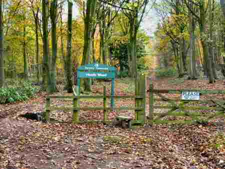
Point 7 – Heath Wood, where the only known Viking Cremation Cemetery in England is to be found. Sixty burial mounds have revealed cremated human remains, fragments of pottery, nails, swords and other objects probably buried in the late 9th century.
Point 8 –The quaintly named Seven Spouts Farm takes its name from seven springs or spouts, which occur naturally and bubble up out of the rock formation nearby. Until recently they were the source of water for the whole of the neighbouring village of Ingleby. The farm is now a housing complex.
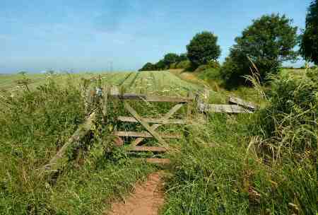
Point 9 – The Hangman’s Stone, which is a short distance to the right of the stile, is where, according to tradition a sheep stealer was hung. There are good views of the surrounding countryside near this point and wildlife is in abundance.
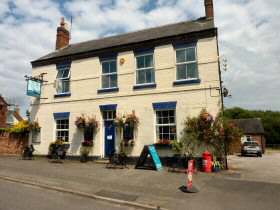
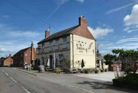
Point 12 – Milton is a small attractive village lying about one mile to the east of Repton, consisting of about 60 dwellings. It was owned by Thomas Burden in 1602, he moved from Bramcote to marry a local heiress. In 1607 the estate came into the hands of the Burdett family. The old mission room provided by the Burdett’s is now the village hall. The Swan Inn is now the only remaining public house in the village
WALK DETAILS
Length: 6.25 miles.
Start: On the B5008 Willington to Burton Road, there is a small car park, about 80 yards from the village cross on Burton Road (SK304269). Alternatively, park on the main street where it widens out near the Bull’s Head. Please ensure you dress appropriately and carry the correct Ordnance Survey Map – OS Explorer Map – The National Forest 245.
Terrain: An easy walk, with very little ascent or descent along good well-marked paths. A mixture of long open views and woodland.
THE ROUTE
- A short distance south of the Bull’s Head public house, turn left and walk along Pinfold Lane which later becomes Mount Pleasant, until you reach Springfield Road where you turn left.

Repton to Milton Walk - After 30 yards go to the right at a fingerpost sign, up a path leading to a field, which you cross by a fenced path. Go through a stile and continue angling slightly to the right through two more fields, before heading down another field with the hedge close on your right to reach Milton.
- Turn right along the main street and after a few yards, cross the street to a fingerpost sign and walk down a passageway by Brook Farm into a field.
- Follow the discernable path straight down the field, to go over a stile on the left, near the bottom. Follow the waymarked path around Mill Farm, before turning right to go up a slope to cross a stile by a metal gate.
- Continue ahead uphill along a well-trodden path, to go over a stile at the top of the field. Maintain the same direction along a clear path, passing close to an area of woodland, with St Saviours Church soon coming into view on your right.
- Turn left down the access road to the church, then right at the Foremarke Hall sign. Walk along the drive past the hall, with the ornamental lake on your left, and where it bends to the left; keep straight on past a group of college houses.

Ornamental Lake - Continue along the track, which takes you through Heath Wood. After leaving the wood, walk straight down a field to a stile onto a minor road.
- Cross the road and walk down a rough track towards Seven Spouts Farm. Follow the road around the farm complex in a semi-circle and leave along a tarmac access road which rises gently up a slope. When the road bends to the right, keep straight ahead to reach and cross a minor road to a fingerpost sign.
- Head down an enclosed path, at the end of which follow the hedge on your left to reach Hangman’s Stone, a few yards away from a crossroad of paths. Here you turn sharp right and follow the path close to the field boundary.
- At a fork in the path continue straight on, now with the field boundary on your left. Maintain direction through a small area of woodland. On emerging from the woodland, follow the hedge on your left to the top corner of a field.
- Go to the right for a few yards, ignore the first gap and turn left at the second, down a cart track, which you follow to the hamlet of Saw Mill.

Mount Pleasant PH - Turn right up an access road to houses in the hamlet to join the road, which leads into Milton. Continue up the street for a short distance, but before reaching the centre of the village, turn left down a minor road to Repton. A few yards further on turn left at a footpath sign.
- Angle to the right down a field go through a gap and follow a distinct path over two further fields angling further to the right in the second field. On arriving at a minor road, turn right.
- After a few yards, go to the right at a fingerpost sign and follow an obvious path across a field to go over a stile. Continue with the hedge close on your left for two fields, before going through the yard of Ridgeway Farm and down the drive. Keep straight ahead past Mount Pleasant public house, back to Repton and the starting point of the walk.


