DUFFIELD WALK
THE WALK
This is an enjoyable walk that explores the Derwent Valley, between the villages of Duffield and Milford. Mind how you go and be sure to keep to the path and watch out for stray golf balls as you walk through Chevin Golf Course. The Golf Club was opened on 13 October 1894 as a 9-hole course designed by William Lowe. Today, the course covers 18 holes with magnificent views over five counties from Chevin Ridge. The initial planning for the golf course took place at Court House Farm, passed on the walk, where prisoners were once locked up to await the court’s verdict. Nearby is the 13th hole on the course named The Gibbet! The prisoners would not have been amused.
LOOK OUT FOR
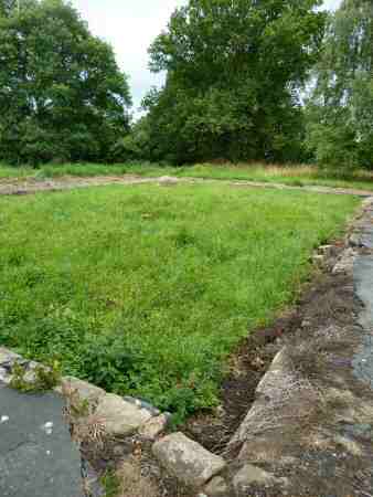
Route Point 1 – Little remains of Duffield Castle which was once a substantial castle. Had it been completed it would have been comparable with the White Tower in London. Located in a commanding position it was built to protect the hunting grounds of Duffield Frith. Today, it is owned and maintained by the National Trust and can be accessed by a flight of steps leading up from the A6 road. All that remains are a few stones.
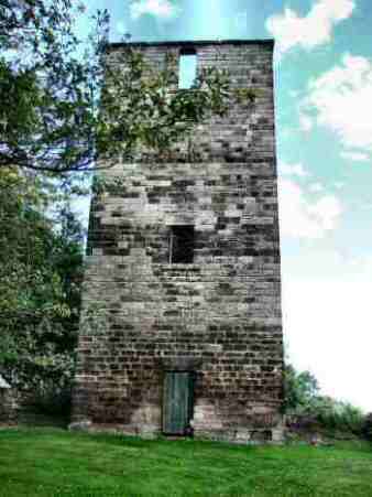
Point 4 – The rather strange-looking Tower at the top of Sunny Hill was always thought to be a sighting point to help railway workers get the line of Milford Tunnel straight. However, following recent research, it is now thought that it was a semaphore point used to signal to drivers when the tunnel was clear. Near this point, it is worth stopping to take in the view of Milford, to look down the narrow valley at the long rows of Strutt’s workers’ cottages running alongside the hillside.
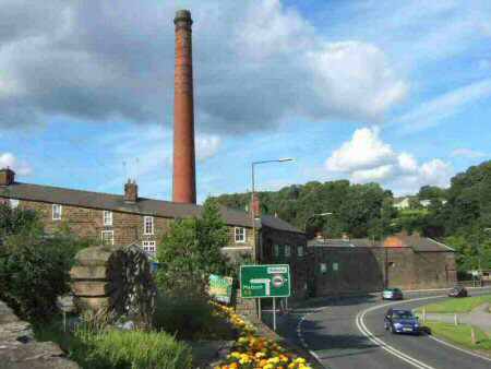
Point 5 – Although the houses and farms built by the Strutt family remain largely intact, the former mills and most of the ancillary buildings have been destroyed. The foundry remains as does Milford Dye-house, built two years after the death of William Strutt. The tall round red-brick chimney that dominates the site, was built in the late 19th century replaced an earlier construction.
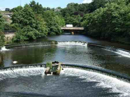
Point 6 – A notable feature to be seen on the south side of the bridge over the Derwent is the double weir. On the east side of the river, the land rises steeply. Where the worker’s cottages were constructed along contours, which run parallel to the road. The terraces are unusual, in that to allow for the steeply sloping site, on the east side they are two storeys high and on the west three. So that all the dwellings had the same accommodation there are three east houses to every two west, even though they are back-to-back
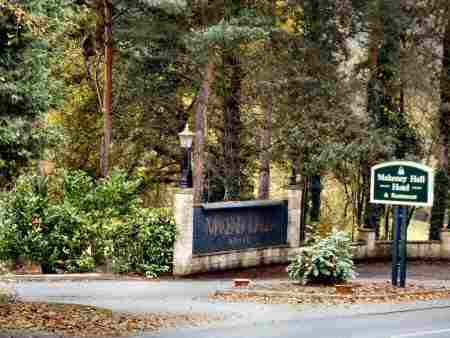
Point 7 – The Strutt family mansion at Milford House, and later Makeney Hall, had a view over most of the workers’ houses in the village. The shutters that protected nearly all the dwellings had holes drilled through them so that internal lights were seen from outside. If any lights were observed still shining after 11 pm, a warning would be sent to the tenants the following day about the dangers of loss of sleep.
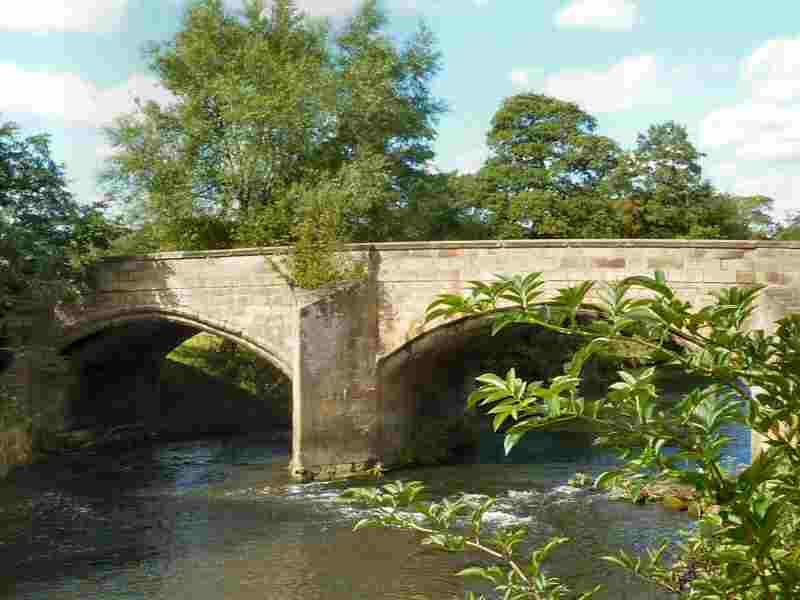
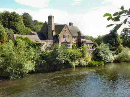
Point 8 – The Bridge Inn is on the corner of Eaton Bank and Makeney Road next to Duffield Bridge (Eyes Bridge) which was widened in the 18th century and became the main road to the north. On the western side of the river The Parish church of St Alkmund’s stands in the water meadows of the River Derwent. It is thought that it is positioned so far from the village because in Anglo-Saxon times it served travellers crossing the river.
WALK DETAILS
Length: 4 miles.
Start: Located on the A6 between Derby and Belper on Town Street where the main shopping area is situated (SK345435).
Terrain: A steady climb up through Chevin Golf Course to North Road. This is followed by a steep descent to Milford. There are good open views over Duffield and the Derwent Valley on the return journey.
THE ROUTE
- From the centre of Duffield (by the shops on Town Street) walk along the A6 towards Belper. The steps up to Duffield Castle are located between Castle Hill and Avenue Road. After viewing what remains of the castle continue along the A6 until you reach Avenue Road, on the edge of the village. Here you turn left and immediately cross the road and go down the path directly opposite, marked ‘Public Footpath to Chevin’.
- After 25 yards the path joins the access road to Chevin Golf Club. Follow the road round through the golf club, to reach a lane leading off to the right, where a finger post sign points the way.
- Just before the lane crosses the golf course, turn left through a stile, at a fingerpost sign, and cross a field keeping close to the field boundary. After crossing a stile, continue keeping close to the hedge, before turning to the right to go over a wide bridge over a stream. Follow the obvious route uphill, with the golf course on your right.
- The path soon curves across a field to a stile in the top corner, at an intersection of paths. Continue uphill, crossing a track and continuing to climb up a short steep slope. At the top, the route levels out to follow a fenced path, by the golf course, where you go over a stile and turn right down North Lane, which soon becomes Sunny Hill. The rather strange-looking Tower at the top of the hill is thought to be a semaphore point used to signal to drivers when the tunnel was clear. From this point, the road descends steeply into Milford.
- Turn right at the bottom of the hill into Chevin Road, before descending a narrow jitty in front of a block of cottages to reach the A6 with the red-brick Mill Chimney clearly in view.
- Continue in a forward direction to cross the bridge over the River Derwent. On your right is the double weir which helped control the water supply for the mills. Once over the bridge, turn right up Makeney Road.
- Continue along Makeney Road, past Makeney Hall, as the road curves gently to the right it changes its name to Duffield Road. Duffield can be easily seen as the walk from Makeney starts to descend with the River Derwent and Eyes Meadow stretching out across the valley floor. It holds a 48-acre sports and recreational site and is the home to an award-winning nature reserve.
- Just before reaching the Bridge Inn go to the right over the river bridge and a few yards further on the railway line.
- Immediately after crossing the latter, go over a stile on your right and follow the perimeter of the field around to the A6.
- Turn right and walk along the footpath by the A6 to reach the centre of Duffield and the starting point of the walk.
REFRESHMENTS
Bridge Inn is located by the bridge over the River Derwent. For more information visit: www.bridgeinnpub.co.uk or telephone 01332 842959. There are also several restaurants and pubs in both Duffield and Milford to choose from as well as the Holly Bush Inn at Makeney.
