
Alstonefield to Butterton
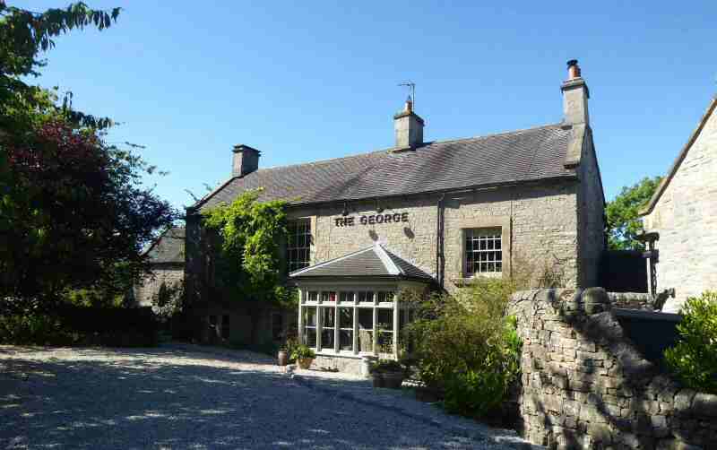
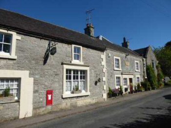
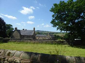
ALSTONEFIELD (midway between Ilam and Hartington – SK131556)
Alstonefield is an unspoilt upland village standing at 900 feet above sea level, just over the Derbyshire border in Staffordshire. It was built on an ancient site where several trackways once crossed, later to become packhorse routes. Today, it is a village of attractive stone houses and pretty gardens with plenty of open space often covered with a triangle of grass rather than a square. The number of awards received in the Best Kept Village Competition endorses the pride shown by local people in the village.
Alstonefield used to be a large parish, covering an area of nearly 24,000 acres and had a population of over 4,500. However, its importance diminished whilst that of neighbouring Hartington and Ashbourne grew. As packhorse trade declined and transportation by canal and rail predominated, its location became more of a hindrance than an asset. Canal and railway engineers ignored the village for geographical reasons, leaving it somewhat isolated.
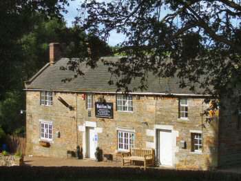
In 1308, Alstonefield was granted a market charter, but there is no record of markets being held regularly and it is believed they were discontinued before 1500. The George, a popular coaching inn, was the centre of activity in the village. A wool market was held in the yard and up until about 100 years ago an annual livestock sale. There was a button factory in Church Street, which made silk-covered buttons and a cheese factory at nearby Hopedale, but both have long since gone out of production.
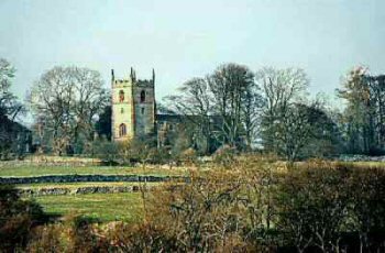
There has been a church at Alstonefield since at least 892, The single benches in the church were presumably for the poor people and contrast strikingly with the much grander Cotton family pew, with the Cotton coat of arms on the back. This was built for Charles Cotton Senior, the owner of Beresford Hall. He was the father of Charles Cotton Junior, a friend of Izaak Walton, a devout Christian who no doubt worshipped at the church. He and Cotton were well known for their love of fishing and Walton wrote the best-selling book The Compleat Angler.
The churchyard contains two interesting gravestones a few yards from the south wall, in line with the porch. Weathered with age, the round-topped tombstone commemorates Anne Green, who died in 1518, making it the oldest memorial to be seen in a graveyard in this country. The other tombstone, which is rectangular, records the death in 1731 of Mary Barclay, aged 107.
AXE EDGE MOOR (between the A53 and A54 near Buxton)
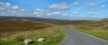
Axe Edge Moor is a wild bleak expanse of land southwest of Buxton. Covered in heather and peat it is the source of the River Dove, River Manifold, River Dane, River Wye and River Goyt. The moor is shared between the counties of Cheshire, Derbyshire and Staffordshire, which meet on its southwestern flank at Three Shire’s Head, the meeting point of four pack-horse trails. The moor’s highest point rises to 1,808 feet. Axe Edge is on the southeastern edge of the moor, near the source of the River Dove.
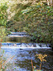
BERESFORD DALE (1.5 miles south of Hartington, off the A5012, in the Dove Valley)
The dale enclosed by trees is one of the prettiest in the Peak District. Alongside the first of two footbridges over the River Dove, when approached from Hartington, is the Pike Pool. This name can confuse as it is not named after some huge fish, but the jagged spike of limestone that rises above the river. When you cross the first bridge you leave Derbyshire and enter Staffordshire returning to the former county a little later when the second bridge is crossed – the River Dove marking the boundary between the two counties.
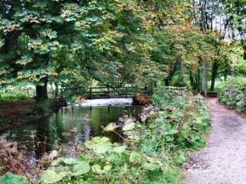
Charles Cotton, who lived at Beresford Hall, now demolished, along with his great friend Izaak Walton, wrote a remarkable book about 17th-century rural England called The Compleat Angler. Charles shared his time between an extravagant lifestyle in London society with the quieter pleasures of the Peak District. That is when his creditors were not chasing him, then it is said he hid in a cave in Beresford Dale. The fishing lodge he built remains on private land in the dale but can be seen from a distance when approaching the dale.
BLORE (5 miles northwest of Ashbourne, 1 mile from Ilam – SK138494)
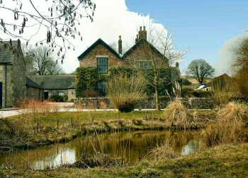
Blore is a small hillside hamlet, with a fine hall, a beautiful old church, an ancient rectory, a few houses and several farms, to the south of Dovedale. A short distance to the west the road descends towards Ilam, with magnificent views in all directions.
Blore Hall was the home of the Bassett family from the middle of the 15th century until 1652 when the family line died out. William Bassett, the last of the male line, died in 1601 and his magnificent alabaster tomb, erected by his wife around 1630, can still be seen in the church. The hall is Grade II listed and is now owned by the Holiday Bond Trust. Blore Church was built around 1100 and is a Grade 1 listed building. It has remained virtually unchanged for almost 400 years.
Sheepdog Trials take place in August at Blore Pasture, which is of interest to both the country lover and city dweller and makes a wonderful spectacle. The English National Sheepdog Trials will be held here in 2020 at the end of July/beginning of August. Competition is always very fierce and a local man, Ben Smith, from Marston Montgomery and his five-year-old collie, Meg, won the English National Sheepdog Trials in 2012.
BRUND (on unclassified roads 2.5 miles southeast of Longnor – SK101611)
Brund is a hamlet in Sheen parish on the edge of the Manifold Valley in farming country. There was formerly a corn mill on the site of Brund Mill, but before the end of the 18th century, a cotton factory operated from the site. It is understood it was used for cotton spinning and calico making. In later years it was used as a sawmill and during the war years for grinding corn. Evidence of early settlement in the area is provided by three Bronze Age barrows.
BUTTERTON (off the B5053, Bottom House to Warslow Road – SK076568)
Situated on the edge of the Staffordshire Moorlands, Butterton commands an elevated location overlooking the beautifully wooded Manifold Valley. Like Grindon, a near neighbour, it is a rather isolated and picturesque village. For visitors entering Butterton by car for the first time from Grindon, a shock awaits, after passing a sign for a ‘Ford.’ You have to drive along the bed of a stream to reach the village centre.
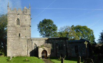
There are some very attractive stone houses built of local sandstone with pretty gardens in the village. However, it is St Bartholomew’s Church with its lofty spire that dominates the landscape. The spire is one of the newest in the Peak having only been built in the late 19th century.
Human habitation has been present in the area from a very early stage as prehistoric barrows, known locally as lows, have revealed spearheads and articles of adornment buried with the owners. There are numerous packhorse routes around Butterton which were used to transport copper and lead ore from Ecton, on the opposite side of the Manifold Valley, to various smelting works.
Following the suggestions of Butterton residents, a War Memorial was designed on 26 October 2006. It was billed at the time as ‘North Staffordshire’s newest War Memorial’. The memorial is set in the church wall and takes the form of a single poppy with the word ‘Remembrance’ underneath. Although the village does not have any recorded casualties, the memorial serves as a reminder of the men and women from Butterton who served their country during wartime.
A further memorial in the church honours Joseph Wood, Rowland Cantrell, William Hambleton and Joseph Shenton with the following inscription: ‘The three first of whom gave their lives in an unsuccessful but heroic attempt to rescue from death the last named, a youth who had descended an un-used shaft on August 30th 1842. This tablet was placed here by an eye-witness of this noble Christian deed.’
PART 2 TBA